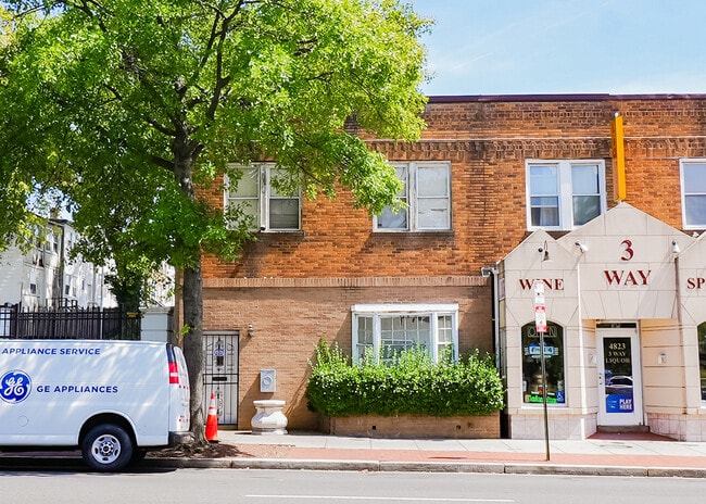
Property Record
4825 Georgia Ave Nw, Washington, DC 20011

NEARBY LISTINGS FOR SALE OR LEASE
Property Detail
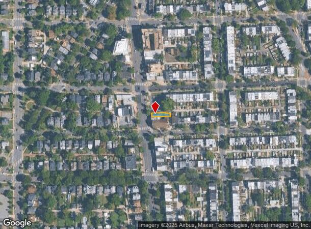
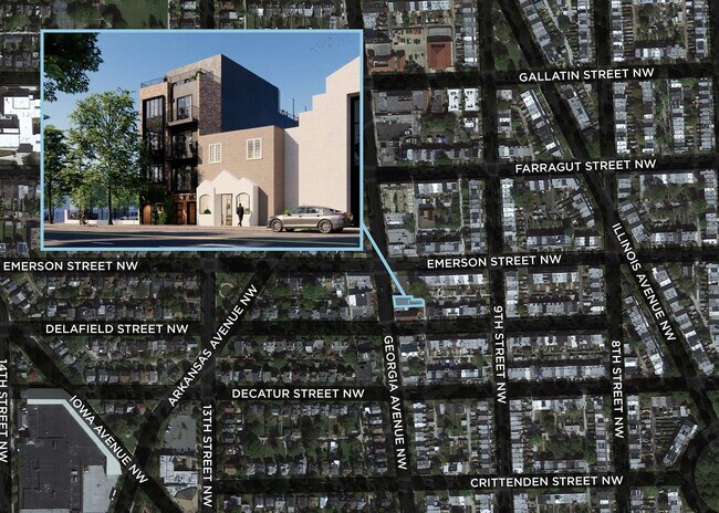
4825 Georgia Ave Nw
Washington-Arlington-Alexandria, DC-VA-MD-WV
Petworth
3011-0191
SQUARE 3011 LOT 0191 NBHD: PETWORTH
Storebuilding
District of Columbia
X
District of Columbia
24033C0110E
191
2025
0.06 AC
2025
Uptown
002201
Washington, DC
1,032 SF
DEMOGRAPHICS near 4825 Georgia Ave Nw
1 Mile
3 Mile
5 Mile
2024 Total Population
42,913
322,289
756,770
2029 Population
38,569
294,407
710,947
Pop Growth 2024-2029
(10.12%)
(8.65%)
(6.06%)
Average Age
38
38
38
2024 Total Households
16,018
147,952
338,622
HH Growth 2024-2029
(10.98%)
(9.52%)
(6.83%)
Median Household Inc
$99,435
$105,774
$104,596
Avg Household Size
2.50
2.10
2.10
2024 Avg HH Vehicles
1.00
1.00
1.00
Median Home Value
$735,473
$746,072
$745,907
Median Year Built
1947
1949
1959
Nearby Places
Map Layers
Map Styles
 Street
 Aerial
- Restaurants
- Banks
- Shops
- Fitness
- Groceries
PUBLIC TRANSPORTATION
TRANSIT/SUBWAY
Georgia Ave-Petworth (Green Line - Washington Metropolitan Area Transit Authority Metrorail (Metrorail), Yellow Line - Washington Metropolitan Area Transit Authority Metrorail (Metrorail))
DRIVE
WALK
Distance
Georgia Ave-Petworth (Green Line - Washington Metropolitan Area Transit Authority Metrorail (Metrorail), Yellow Line - Washington Metropolitan Area Transit Authority Metrorail (Metrorail))
2 min
18 min
0.9 mi
COMMUTER RAIL
Silver Spring (Brunswick Line - Maryland Area Regional Commuter Trains (The MARC))
DRIVE
WALK
Distance
Silver Spring (Brunswick Line - Maryland Area Regional Commuter Trains (The MARC))
9 min
3.2 mi
Union Station (Red Line - Washington Metropolitan Area Transit Authority Metrorail (Metrorail))
DRIVE
WALK
Distance
Union Station (Red Line - Washington Metropolitan Area Transit Authority Metrorail (Metrorail))
11 min
4.5 mi
AIRPORT
Ronald Reagan Washington Ntl
DRIVE
WALK
Distance
Ronald Reagan Washington Ntl
17 min
8.5 mi
Washington Dulles International
DRIVE
WALK
Distance
Washington Dulles International
50 min
27.7 mi
Baltimore/Washington International Thurgood Marshall
DRIVE
WALK
Distance
Baltimore/Washington International Thurgood Marshall
45 min
33.5 mi
Freight Ports
Port of Baltimore
DRIVE
WALK
Distance
Port of Baltimore
48 min
36.2 mi
SALE & LEASE HISTORY
LISTING DATE
SALE/LEASE

Sep 19, 2024
For Sale
Nov 02, 2023
For Sale
Nearby Properties
Address
Land Use
TOTAL SIZE
Lot Size
Zoning
Address
Land Use
TOTAL SIZE
Lot Size
Zoning
1,583,364 SF
276.66 AC
UNZONED
Address
Land Use
TOTAL SIZE
Lot Size
Zoning
553,914 SF
55.91 AC
R-1B
Address
Land Use
TOTAL SIZE
Lot Size
Zoning
1,562,988 SF
15.33 AC
MU-10 (IZ+
Address
Land Use
TOTAL SIZE
Lot Size
Zoning
95.32 AC
RA-1
Address
Land Use
TOTAL SIZE
Lot Size
Zoning
247,900 SF
170.58 AC
RA-2;UNZON
Address
Land Use
TOTAL SIZE
Lot Size
Zoning
1,835,827 SF
34.66 AC
UNZONED
Address
Land Use
TOTAL SIZE
Lot Size
Zoning
Address
Land Use
TOTAL SIZE
Lot Size
Zoning
791,730 SF
37.44 AC
RA-1
Address
Land Use
TOTAL SIZE
Lot Size
Zoning
795,214 SF
MU-5A
Address
Land Use
TOTAL SIZE
Lot Size
Zoning
1,095,275 SF
30.70 AC
MU-4;RA-2
Address
Land Use
TOTAL SIZE
Lot Size
Zoning
823,802 SF
7.30 AC
MU-2
Address
Land Use
TOTAL SIZE
Lot Size
Zoning
10,158 SF
97.34 AC
MU-10;MU-1
Address
Land Use
TOTAL SIZE
Lot Size
Zoning
186,952 SF
9.46 AC
RA-2;RF-1
Address
Land Use
TOTAL SIZE
Lot Size
Zoning
256,187 SF
8.97 AC
RA-2
Address
Land Use
TOTAL SIZE
Lot Size
Zoning
902,764 SF
2.87 AC
MU-5A
Address
Land Use
TOTAL SIZE
Lot Size
Zoning
1,237,319 SF
4.37 AC
RA-4
Address
Land Use
TOTAL SIZE
Lot Size
Zoning
244,615 SF
19.61 AC
R-1A/FH
Address
Land Use
TOTAL SIZE
Lot Size
Zoning
69.17 AC
R-1B
Address
Land Use
TOTAL SIZE
Lot Size
Zoning
520,000 SF
2.65 AC
MU-10;RA-5
Address
Land Use
TOTAL SIZE
Lot Size
Zoning
356,114 SF
2.97 AC
D-5
Address
Land Use
TOTAL SIZE
Lot Size
Zoning
516,328 SF
13.19 AC
R-1B
Address
Land Use
TOTAL SIZE
Lot Size
Zoning
316,393 SF
13.61 AC
R-1A
Address
Land Use
TOTAL SIZE
Lot Size
Zoning
281,191 SF
0.54 AC
D-2
Address
Land Use
TOTAL SIZE
Lot Size
Zoning
1,053,971 SF
4.19 AC
R-1A/FH;RA
Address
Land Use
TOTAL SIZE
Lot Size
Zoning
343,585 SF
0.97 AC
MU-2;RA-5
Address
Land Use
TOTAL SIZE
Lot Size
Zoning
248,643 SF
8.66 AC
RA-1
Address
Land Use
TOTAL SIZE
Lot Size
Zoning
280,000 SF
0.82 AC
RA-2
Address
Land Use
TOTAL SIZE
Lot Size
Zoning
287,092 SF
0.70 AC
MU-1/DC
Address
Land Use
TOTAL SIZE
Lot Size
Zoning
357,983 SF
0.78 AC
MU-2/DC
Address
Land Use
TOTAL SIZE
Lot Size
Zoning
255,095 SF
0.73 AC
MU-9B/DC
The World's #1 Commercial Real Estate Marketplace
Connect with us
© 2025 CoStar Group
The information above has been obtained from sources believed reliable. While we do not doubt its accuracy we have not verified it and make no guarantee, warranty or representation about it. It is your responsibility to independently confirm its accuracy and completeness. Any projections, opinions, assumptions, or estimates used are for example only and do not represent the current or future performance of the property. The value of this transaction to you depends on tax and other factors which should be evaluated by your tax, financial, and legal advisors. You and your advisors should conduct a careful, independent investigation of the property to determine to your satisfaction the suitability of the property for your needs.